2007 Colorado Plateau
 

Glen Canyon

Our journey continues south to Hite Overlook,  just north of White Canyon at the upper reaches of Lake Powell, in the Glen Canyon Recreational area.
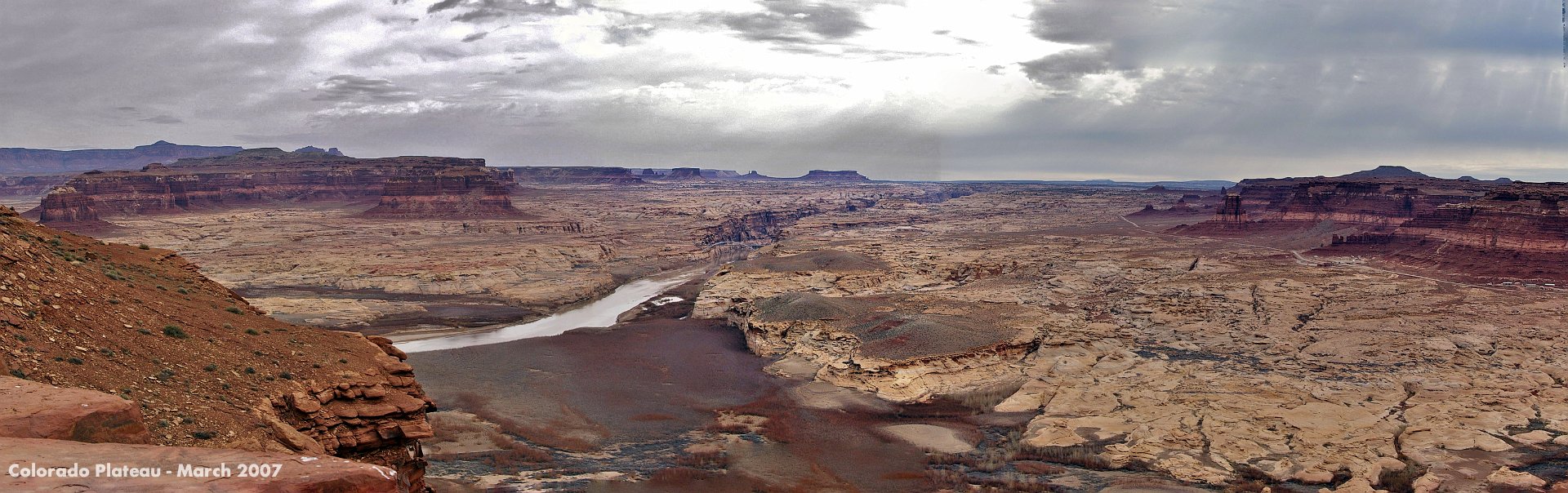
1 Our journey continues south to Hite Overlook, just north of White Canyon at the upper reaches of Lake Powell, in the Glen Canyon Recreational area.
The Glen Canyon Dam opened in 1966 after 10 years of construction.
2 The Glen Canyon Dam opened in 1966 after 10 years of construction.
Hite has a ranger station, gas station and a general store (now open only intermittently) and that's it
3 Hite has a ranger station, gas station and a general store (now open only intermittently) and that's it
Hite is in the northern reaches of the Glen Canyon Recreational Area and recreational vehicles are banned here.
4 Hite is in the northern reaches of the Glen Canyon Recreational Area and recreational vehicles are banned here.
The Glen Canyon dam stores water from the Colorado River and its tributaries. As can be seen, this is a particularly dry season.
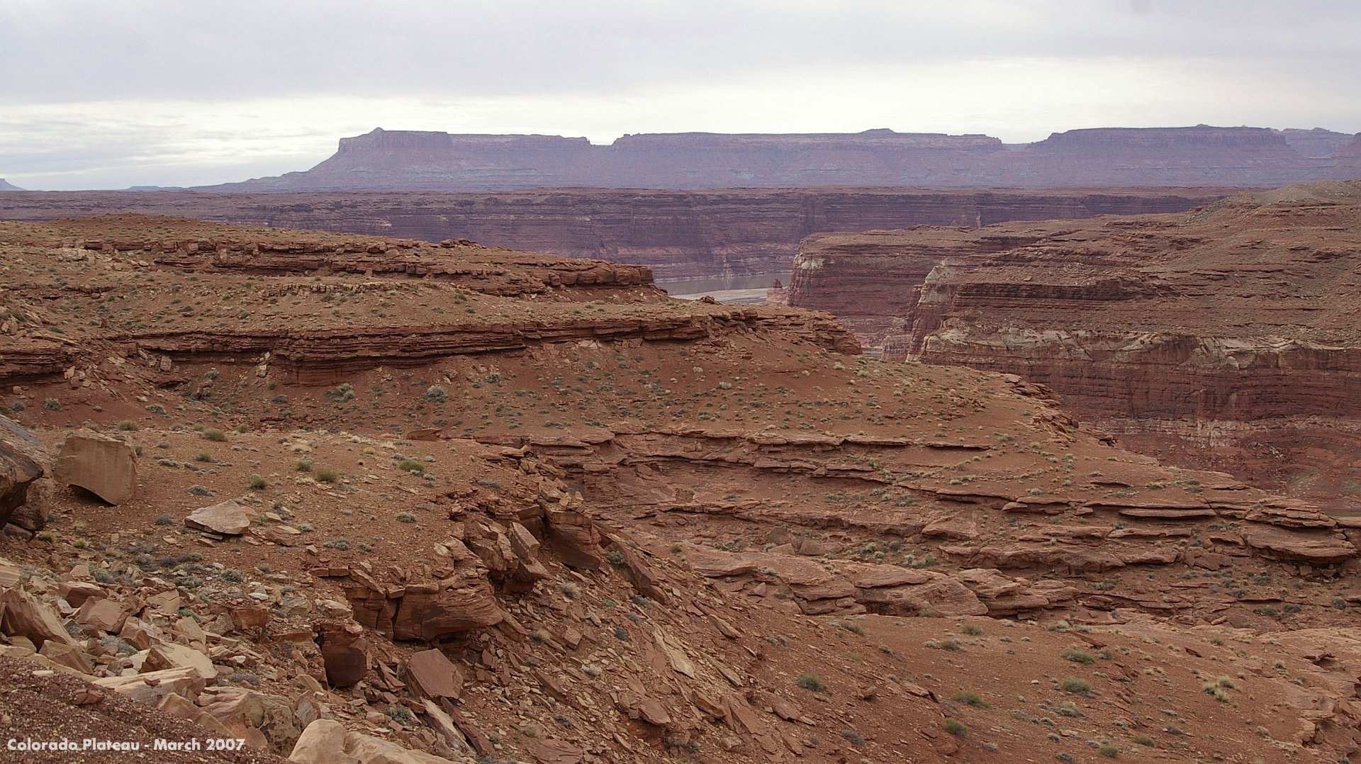
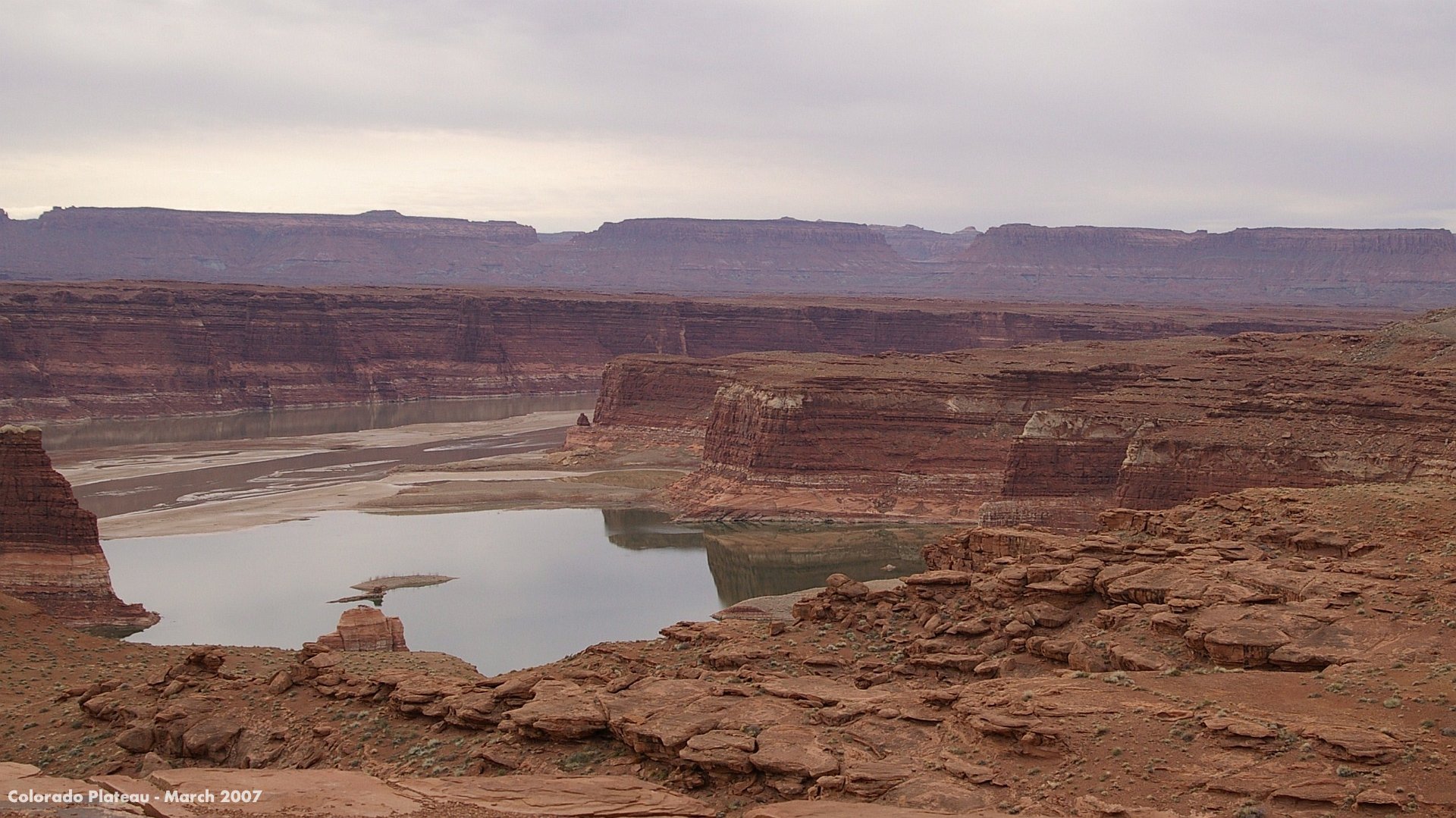
5 The Glen Canyon dam stores water from the Colorado River and its tributaries. As can be seen, this is a particularly dry season.
After the Glen Canyon dam, the Colorado flows through the Grand Canyon after which the Hoover Dam captures most of the remaining water. The  Hoover Dam opened in 1936 after 5 years construction and created Lake Mead.
6 After the Glen Canyon dam, the Colorado flows through the Grand Canyon after which the Hoover Dam captures most of the remaining water. The Hoover Dam opened in 1936 after 5 years construction and created Lake Mead.
Beyond the Hoover Dam the little water that remains trickles along the California border where it is used to irrigate the desert, and then through Mexico, exhausted, into the Gulf of California
7 Beyond the Hoover Dam the little water that remains trickles along the California border where it is used to irrigate the desert, and then through Mexico, exhausted, into the Gulf of California
Hite, visible in the centre right, is a tiny community at the northeastern end of Lake Powell. It used to have a small marina but it  is closed due to low lake levels.
8 Hite, visible in the centre right, is a tiny community at the northeastern end of Lake Powell. It used to have a small marina but it is closed due to low lake levels.
There are no paved roads through the magnificent scenery in the distance to the east; 4X4 only. It is part of the SE region of Canyonlands National Park. We cross the bridge from left to right and continue travelling in a generally southerly direction.
9 There are no paved roads through the magnificent scenery in the distance to the east; 4X4 only. It is part of the SE region of Canyonlands National Park. We cross the bridge from left to right and continue travelling in a generally southerly direction.
We continue southeast down SR 95 to the Natural Bridges National Monument in Utah.   Natural Bridges is next
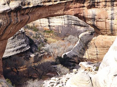
10 We continue southeast down SR 95 to the Natural Bridges National Monument in Utah. Natural Bridges is next
  
Natural BridgesNext: Natural Bridges Capitol ReefPrevious: Capitol Reef
jAlbum - online photo sharing & TurtleSkin: Turtle Gold, 5.6.7 Download