Saturday 2007-03-10 Glen Canyon Recreational Area, Utah Our journey continues south to Hite (too small to show on the map), just north of White Canyon at the upper reaches of Lake Powell in the Glen Canyon Recreational area. The Glen Canyon Dam opened in 1966 after 10 years of construction. |
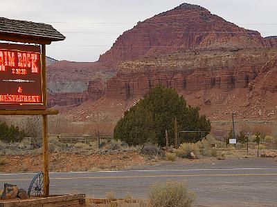
 Saturday 2007-03-10 Hite, Glen Canyon Recreational Area Hite, visible in the distance, is a tiny community at the northeastern end of Lake Powell. It used to have a small marina but it is closed due to low lake levels. |
 Saturday 2007-03-10 Colorado River, Utah There is little more to Hite besides a ranger station, gas station and a general store (now open only intermittently), |
 Saturday 2007-03-10 Hite, Glen Canyon Recreational Area, Utah Hite is in the northern reaches of the Glen Canyon Recreational Area and recreational vehicles are banned here. |
 Saturday 2007-03-10 Glen Canyon Recreational Area, Utah The Glen Canyon dam stores water from the Colorado River and its tributaries that had its origins in the melting snows of the Rocky Mountains farther to the NE. As can be seen, this is a particularly dry season. |
 Saturday 2007-03-10 Glen Canyon Recreational Area, Utah After the Glen Canyon dam, the Colorado flows through the Grand Canyon after which the Hoover Dam captures most of the remaining water. The Hoover Dam opened in 1936 after 5 years construction and created Lake Mead. |
 Saturday 2007-03-10 Glen Canyon Recreational Area After the Hoover Dam the little water that remains trickles along the California border where it is used to irrigate the desert, and then through Mexico, exhausted, into the Gulf of California. |
 There are no paved roads through the magnificent scenery in the distance to the east; 4X4 only. It is part of the SE region of Canyonlands National Park. We cross the bridge from left to right and continue travelling in a generally southerly direction. |
 We continue southeast down SR 95 to the Natural Bridges National Monument in Utah. |
 Saturday 2007-03-10 SR95 Utah It is only 52 miles from Hite to the Natural Bridges National Monument. |
 Saturday 2007-03-10 Natural Bridges National Monument, Utah This is the Sipapu Bridge. It is in middle age where stream action no longer cuts the bridge. The three bridges in the park are at different stages of their "life" cycle. |
 Saturday 2007-03-10 Natural Bridges National Monument, Utah The next bridge we visit is the young Kachina Bridge. |
 Saturday 2007-03-10 Natural Bridges National Monument, Utah Stream action is still cutting its way through the Kachina bridge. This rock is sandstone and it was deposited about 270-260 MYA . |
 The rock through which the rock was cut is sandstone that was deposited during the Permian about 270-260 MYa. |
 Saturday 2007-03-10 Natural Bridges National Monument, Utah The Owachomo bridge is in extreme old age. |
 Saturday 2007-03-10 Natural Bridges National Monument, Utah Stream action stopped thousands of years ago leaving the Owachoma Bridge high and dry. |
 Saturday 2007-03-10 Natural Bridges National Monument, Utah However, the same forces that create arches are still at work and they continue to eat away at the bridge. It will fall down shortly (geologically speaking). |
 Saturday 2007-03-10 Natural Bridges National Monument, Utah You can see the cracks starting to form and one or more of them may be fatal. The trees are Pinyon and juniper. |
 Saturday 2007-03-10 Natural Bridges National Monument, Utah This is a baby Pinon Pine clinging to life in the sandstone. |
 Saturday 2007-03-10 Valley of the Gods, Utah About 30 miles from the Natural Bridges National Monument, we drop over the edge of a cliff into the Valley of the Gods. Exactly at that time, as we are traversing the switchbacks of the gravel road, the battery in my camera goes flat. |
 It is a couple of thousand feet to the valley floor - to the Valley of the Gods. A dirt road takes you into the valley itself which has similar geologic structures to Monument Valley. |
 Saturday 2007-03-10 US163, Utah We then head east along US 163 to the little town of Bluff, Utah. Just before Bluff are these fascinating wavy rock formations. The waves were made when pressure on both sides of fault lines pushed against each other. |
 Saturday 2007-03-10 SR 261, Utah Our route from the Natural Bridges takes us down UT 261 and then east on US 163 to Bluff. |
 Saturday 2007-03-10 Bluff, Utah Bluff is where we stayed overnight with Bonnie and Dennis on our first trip with them and where we stayed again in 2004 on our trip from Tucson to Seattle. We rediscover the Twin Rocks Cafe where Navajo bread is the speciality of the house. |
 After lunching on a Navajo burger, we continue south. The scenery remains remarkable. |
 Saturday 2007-03-10 Bluff, Utah From Bluff we head for Canyon de Chelly. After about 25 miles we cross the Utah border into Arizona. |
 Saturday 2007-03-10 US163, Arizona The scenery remains spectacular. We enter the ramshackle Navajo Nation on Indian Route 59. |
 Saturday 2007-03-10 Canyon de Chelly, Arizona These are the cliff dwellings once used by the Anasazi. They lived here beginning some 5000 years ago and moved away about 700 years ago. |
 Saturday 2007-03-10 Canyon de Chelly, Arizona The park's distinctive geologic feature is Spider Rock, a sandstone spire that rises 800 feet from the canyon floor at the junction of Canyon de Chelly and Monument Canyon |
 Saturday 2007-03-10 Canyon de Chelly, Arizona According to traditional Navajo beliefs, the taller of the two spires is the home of spider woman. |
 Saturday 2007-03-10 Canyon de Chelly, Arizona The oldest rocks in Canyon de Chelly are 280 million years old. At this time northeastern Arizona was subtropical. |
 Saturday 2007-03-10 Canyon de Chelly, Arizona Fossil plants found in the mud, silt, and sandstone indicate that the climate was hot and moist. |
![Saturday 2007-03-10 Canyon de Chelly, Arizona The canyons were cut by streams with headwaters in the Chuska mountains just to the east of the monument. None of the land is federally owned.[5]](slides/2007%2003%2010%20USA%20084.jpg) Saturday 2007-03-10 Canyon de Chelly, Arizona The canyons were cut by streams with headwaters in the Chuska mountains just to the east of the monument. None of the land is federally owned.[5] |
 Saturday 2007-03-10 Canyon de Chelly, Arizona The White House ruins were built by ancient Puebloan people who occupied them about 1000 years ago. The ruins are named for the long wall in the upper dwelling that is covered in white plaster. |
 Saturday 2007-03-10 Canyon de Chelly, Arizona An arch is starting to form. |
 Saturday 2007-03-10 Canyon de Chelly, Arizona At the White House overlook. |
 Saturday 2007-03-10 Holbrook, Arizona After Canyon de Chelly, we continue south and connect with I40 just as darkness arrives. It is very unpleasant driving into the setting sun; it seems to take forever to set. We spend the night in Holbrook in a motel on the old Route 66. |
 Sunday 2007-03-11 Heading south, Arizona The next moring we head for Tucson via Show Low, Globe and the Oro Valley. |
 Sunday 2007-03-11 Heading south, Arizona We have been through Show Low and are now 20 miles north of Globe on US 60. These are great motorcycle roads. |
 We drive non-stop to Globe where we stop for brunch. Globe turns out to be where we had stopped overnight on our first trip with B&D so I take a picture of the motel for old times sake. |
 Sunday 2007-03-11 Heading south, Arizona A sure sign that you are entering the Sonoran Desert is when the Saguaro Cactus start to appear. Next folder: Tucson |