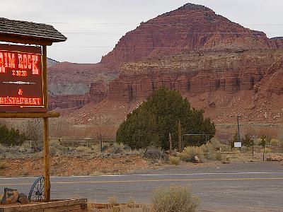
Friday 2007-03-09 US89, Utah It is 85 miles to Bryce Canyon but it takes nearly 2 hours. We drive through a fabulous tunnel, 1.7 km long built in 1930. |
 Friday 2007-03-09 Bryce Canyon National Park, Utah It always exciting for us when we see deer |
 Friday 2007-03-09 Bryce Canyon National Park, Utah This is Sunrise Point just after entering the park. It is part of the largest natural amphitheatre in the park. The rock formations in Bryce Canyon began to develop during the Cretaceous Period 144-63 MYA. The rocks in Bryce Canyon are younger than those in Zion. |
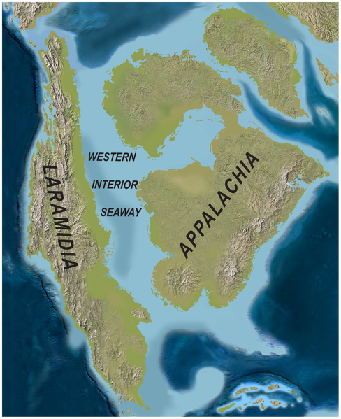 Friday 2007-03-09 Bryce Canyon National Park, Utah For 60 million years during the Cretaceous, a great seaway extended northwestward into this area depositing sediments thousands of feet thick. Their remnants form the oldest, lowest, gray-brown rocks at Bryce Canyon. |
 In the Tertiary Period, between 66-40 MYA, highlands to the west eroded into shallow, broad basins. Iron-rich, limy sediments were deposited in the beds of a series of lakes and streams. |
 These sediments became the reddish rocks of the Claron Formation (the whole) from which the hoodoos (individual columns) are carved and for which the Pink Cliffs (35 miles long) are named. |
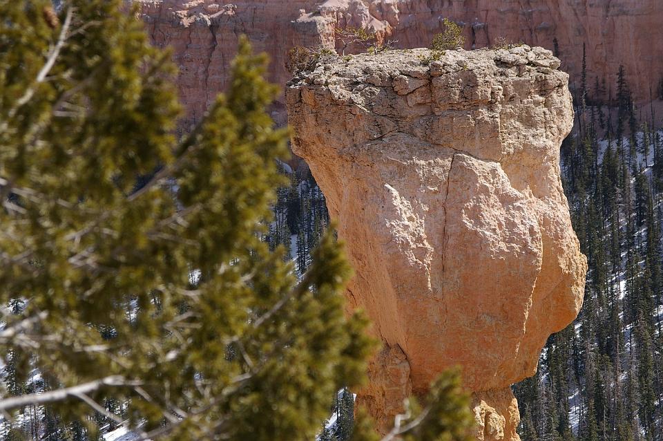
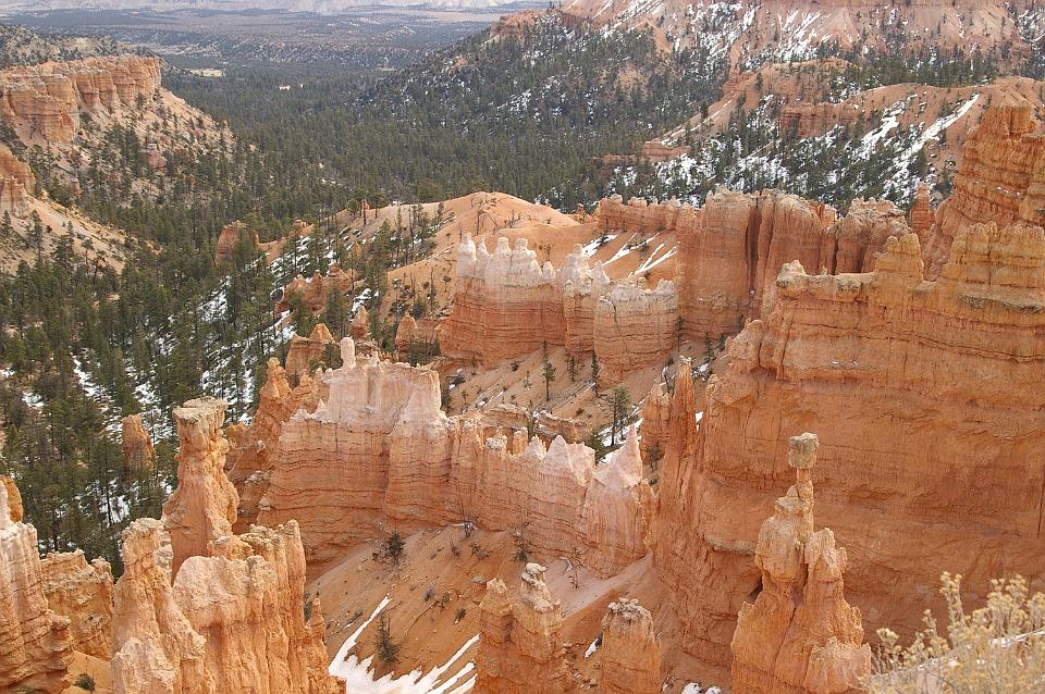 Geologically, the cliffs are pink and red-coloured Claron Formation limestones, forming the upper riser of the Grand Staircase that descends southward from here to the Grand Canyon in Arizona. The balancing rock in the right foreground is called Thor's Hammer. |
 This is the actual Bryce Canyon between Sunrise and Sunset Points. |
 Sunset Point is an amazing 8000 ft elevation. No wonder it's cold and there's snow around. |
 The lookout at Sunset Point. |
 Navajo Loop is a walking trail that gives spectacular views of of the whole amphitheatre area. |
 Jenni took some great video. |
 Hoodoos are composed of soft sedimentary rock and are topped by a piece of harder, less easily eroded stone that protects the column from the elements. |
 Bryce Canyon has one of the highest concentrations of hoodoos of any place on Earth. They are formed by a combination of atmospheric and chemical weathering. |
 My Queen |
 The rim trail goes from Sunset Point back to Sunrise point. |
 From the trail, you get tremendous views of the amphitheatre. |
 This could be a Limber Pine, so named because of its flexibility in winds. These grow at lower elevations in the park. |
 At the top of each hoodoo is a harder stone or rock around which the weathering originally began. When the rock wears away, the rest of the column quickly follows. |
 The three trees with the brown trunks are Ponderosa Pines. The ones on the right are possibly Junipers. |
 At about this altitude, Ponderosa Pines start to give way to Douglas Fir and White Fir. |
 Apparently, on a clear day, you can see the Kaibab Plateau of the Grand Canyon - about 150 kms away. |
 It's an amazing view. |
 Friday 2007-03-09 Bryce Canyon National Park, Utah The three previous pictures stiched together. |
 We keep driving higher and reach the Natural Bridge overlook |
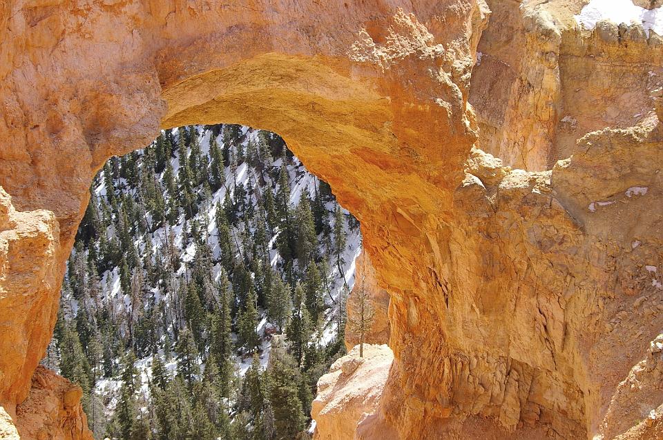 True natural bridges are formed by a stream. This is more correctly an arch because it was formed by the action of rain and frost erosion. |
 No stream runs through here. |
 |
 As we drive higher, we start to see snow. |
 There is still another 10 km to go to the end of the drive. |
 This hoodoo has small trees growing on its top. |
 This hoodoo is called the Hunter. |
 This is another interesting hoodoo at Agua Canyon. |
 |
 |
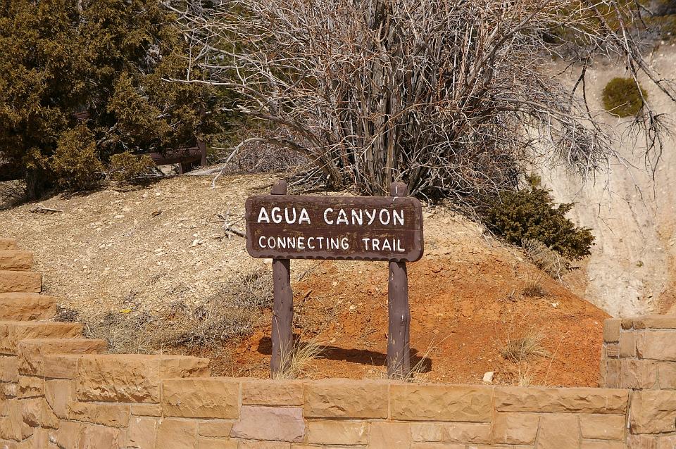 It's about 1 km back to Agua Canyon and the trail follows the rim. |
 The Ponderosa Canyon. |
 The road to Rainbow Point is in perfect condition. |
 |
 Black Birch Canyon. |
 Black Birch Canyon |
 There's plenty of snow around as we drive higher. |
 |
 We're nearing the end of the road along the canyon rim. |
 From Rainbow Point. |
 |
 The lookout at Rainbow Point. |
 On a very clear day, the view supposedly extends into New Mexico about 280 kms away to the east. |
 The brochure says that you can see Navajo Mountain 130 kms away from Rainbow Point. I think that's Navajo Mountain faintly visible in the far distance in about 1/3 from the left centre. It's a 5hr 40min roundabout drive to get there. |
 Friday 2007-03-09 Bryce Canyon National Park, Utah Stitched |
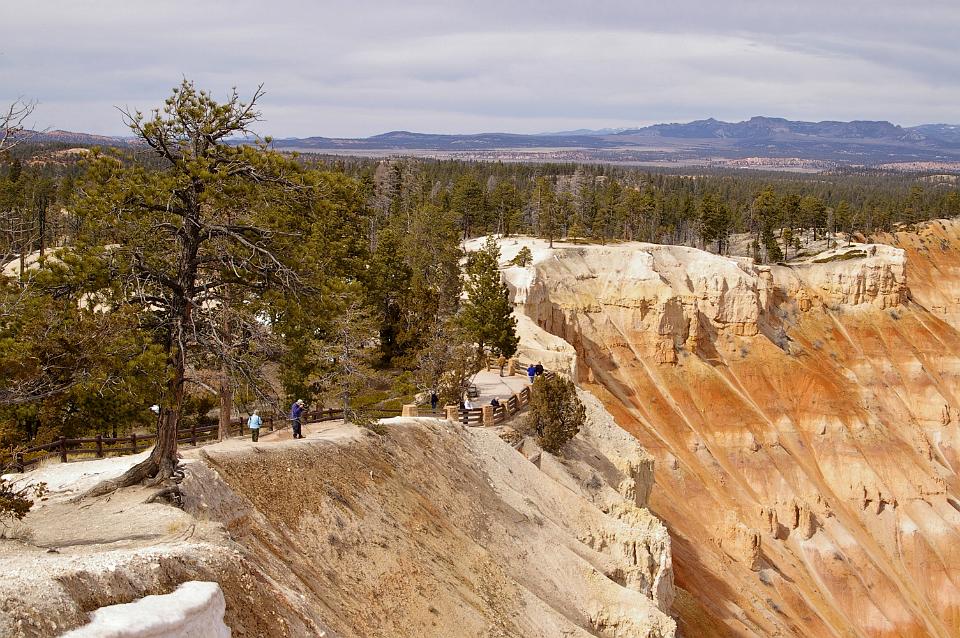
 On the way up, we missed Inspiration Point. It's the next one along from Sunset Point so we catch it on the way back down. |
 Inspiration Point looks into the Bryce Amphitheatre. |
 This hoodoo looks a bit like a, don't know what it looks like really. |
 |
 We have to walk up the hill to get to Inspiration Point. |
 |
 On the way out of the park we spot some more deer. |
 Nearing the exit, we spot more deer |